
“Revolutionizing Crop Data: Key Rules & Reforms in the 2025 Digital Crop Survey”
Introduction
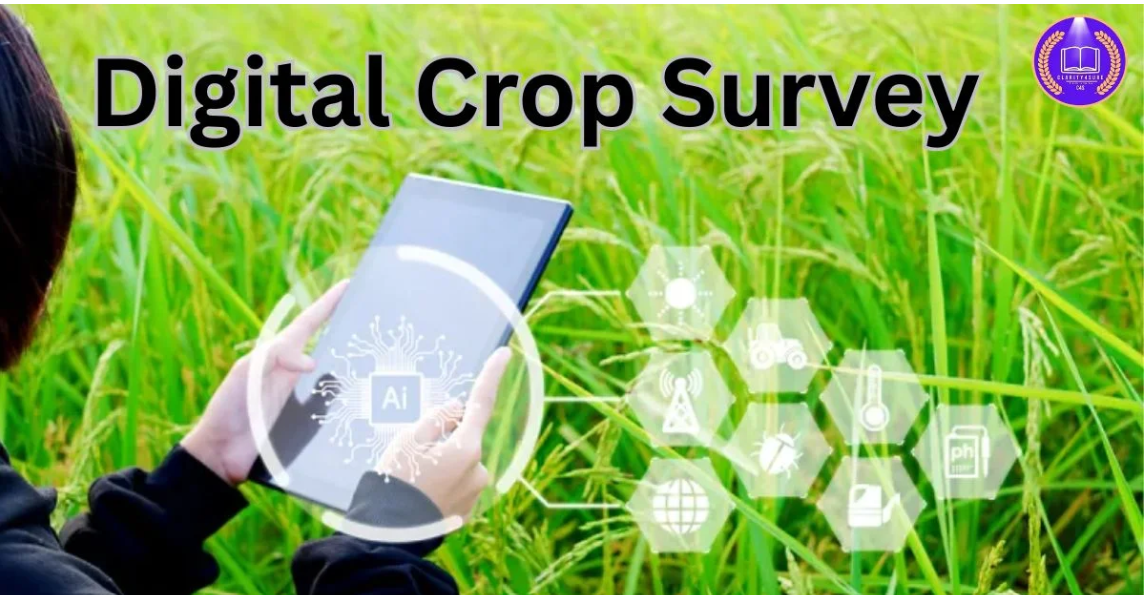
Agriculture remains the backbone of India’s economy, and accurate crop statistics (area, yield, sowing) are essential for planning, support schemes, insurance, procurement, and risk mitigation. Recognizing the limitations of manual surveys, the Government of India is pushing a paradigm shift via Digital Crop Survey (DCS) and associated reforms in 2025.
These “new rules” aim to make crop data collection more real-time, reliable, transparent, and farmer-friendly. This blog unpacks all major changes, their implications, challenges, and what farmers and officials should do to adapt.
What Is Changing: Key Reforms in Crop Survey 2025
Here’s a breakdown of major new or strengthened rules being introduced:
| Reform / Rule | What Changes | Rationale / Benefit | Challenges / Considerations |
|---|---|---|---|
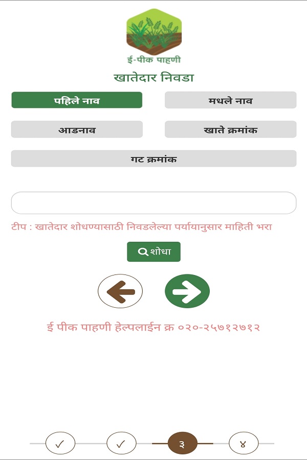
| Mandatory Digital Crop Survey (DCS) | All states/UTs must digitize area enumeration (girdawari) and collect plot-level data via mobile/GPS apps. (Vajiram & Ravi) | Removes manual errors, speeds up data collection, enables real-time monitoring. | Infrastructure gaps (internet, devices), training of staff, connectivity in remote areas. |
| Georeferencing & Geotagging of Plots | Every agricultural plot must have geotagged boundaries, and crop photos with geocoordinates. (Directorate of Municipal Administration) | Helps confirm actual crop coverage, reduces misreporting, improves spatial analytics. | Accurately mapping small or irregular plots; ensuring devices and app accuracy. |
| Farmer Digital Identity / Farmer Registry (FID / Kisan ID / State Farmer Registry) | All farmers to be uniquely identified, linking land records + Aadhaar + other data. (Financial Express) | Helps in targeted delivery of subsidies, schemes, insurance, benefit transfers. | Ensuring inclusion (tenant / lessee farmers), resolving discrepancies, data privacy concerns. |
| Consent-based Data Sharing & Privacy Safeguards | Crop survey and farmer data will be collected only with farmer consent; data shared only for authorized purposes. (पार्टी माहिती ब्यूरो) | Builds trust, ensures transparency, aligns with Digital Personal Data Protection Act. | Educating farmers about rights, preventing misuse of data, securing digital infrastructure. |
| Integration with Scheme Eligibility & Benefit Transfers | The DCS and farmer registry will be used to validate eligibility for subsidies, PM Kisan, crop insurance, credits etc. (Financial Express) | Reduces duplicate claims, fraud, speeds up disbursement, better alignment of schemes with real data. | States must upgrade backend systems, ensure real-time integration across departments. |
| New Timelines & Revised Estimate Release Schedule | Some phases of estimate releases are being revised; final estimates may come earlier (e.g. in September–October) rather than February. (Vajiram & Ravi) | Quicker availability of data helps in responsive policymaking and market interventions. | States must tighten field operations and workflows to meet tighter deadlines. |
| Grievance & Verification Mechanisms / 1% Sample Verification | A small percentage of plots may be re-verified for quality checks; grievance redressal for farmers to correct errors. | Improves data accuracy and gives farmers the right to contest errors. | Ensuring fairness, transparency, and responsiveness in grievance mechanism. |
| State Discretion for Tenant / Lessee Inclusion | States may decide whether to include tenant/lessee farmers into registry and crop survey. (पार्टी माहिती ब्यूरो) | Increases inclusivity and reaches farmers who don’t own land. | Policy uniformity across states; ensuring protection of tenant rights. |
| Technical Support & Capacity Building | Provision of training, devices, mobile apps, help desks, data support for states. (CDN BBSR) | Essential to make the transition smooth and help ground-level staff. | The scale and standardization of training, maintenance of devices. |
How It Works: Workflow in the 2025 Digital Crop Survey
- Farmer Registration / Identity Linking
- Each farmer will register (or be on-boarded) into the State Farmer Registry / FID / Kisan ID, linking land records, Aadhaar, bank account, etc.
- Tenant/lessee farmers may also be included (as per state policy).
- Pre-Survey Preparation
- State departments will ensure georeferencing of plots and prepare maps and satellite images.
- Field staff are issued GPS-enabled mobile devices or apps for data entry.
- On-field Data Capture
- Staff visit each plot and record: crop name, variety, area, sowing date, irrigation type, geotagged photos of plot and crop, plot boundary geocoordinates, etc.
- The app captures metadata (timestamp, GPS, device ID) to ensure authenticity.
- Upload & Aggregation
- Data from field devices are uploaded via APIs to central/state servers in real time (or periodic sync).
- Village-level, block-level, district-level aggregation is automated.
- Verification & Sample Checks
- A small sample (~1 %) of plots may be cross-checked or physically re-inspected to validate data accuracy.
- Farmers are allowed to raise grievances or corrections via a portal within a stipulated timeframe.
- Data Usage for Schemes / Policies
- The validated crop data is then fed into systems for scheme eligibility (subsidies, PM Kisan, crop insurance).
- Helps in procurement planning, forecasting, risk assessments, and pricing decisions.
- Estimate Release & Monitoring
- Crop area and yield estimates will be progressively released.
- Final consolidated estimates (across states and seasons) are expected earlier (e.g. September–October). (Vajiram & Ravi)
Implications & Benefits
For Farmers
- Faster, more transparent access to subsidies, insurance, credit
- Reduction in duplicate claims and fraudulent disbursements
- Ability to correct data errors via grievance redressal
- Better alignment of schemes with actual cropping
For Government / Policy Makers
- More accurate, near-real time crop statistics
- Quicker decision making (procurement, import/export, subsidies)
- Reduced leakages and fraud
- Enhanced planning for drought, calamity compensation
For Market / Economy
- Better forecasting for commodity markets, supply chain planning
- Minimization of distortion due to incorrect area estimates
- More efficient resource allocation (water, input subsidies)
Challenges & Risks
- Digital Divide: Many remote areas have poor connectivity or lack of devices.
- Staff Capacity: Training many field staff to use geospatial tools is a big task.
- Data Quality & Manipulation Risks: Ensuring real data vs. fudged entries.
- Inclusion Issues: Tenant farmers, sharecroppers may get excluded if not well accounted.
- Privacy & Consent: Farmers must understand their rights and how data is used.
- State Coordination: Uniform adoption across states will be uneven.
What Farmers & Officials Must Do to Adapt
- Farmers
- Ensure their land records, Aadhaar, bank accounts are updated and linked.
- Cooperate during geotagging / surveying.
- Check their recorded data in the registry and report discrepancies.
- Participate in awareness programs to understand data privacy, consent.
- Officials / Departments
- Accelerate georeferencing and mapping of agricultural parcels.
- Deploy adequate devices (smartphones, tablets) and ensure connectivity.
- Conduct large-scale training of field staff in survey apps and GIS tools.
- Build or upgrade data integration infrastructure (APIs, servers, security).
- Monitor sample verification, audits, and grievance redressal mechanisms.
Potential Case Example & Recent Developments
- The Digital Crop Survey (DCS) system was officially launched in March 2025 to capture crop-sown data via mobile tools and enable real-time, accurate collection. (पार्टी माहिती ब्यूरो)
- In states, georeferencing of plots has been mandated before DCS can proceed. (Directorate of Municipal Administration)
- The government is already using the crop registry and survey data to validate eligibility under PM Kisan and tie them with digital farmer IDs. (Financial Express)
Conclusion
The 2025 overhaul in crop survey rules marks a transformative shift—from manual, periodic estimation to a dynamic, data-driven system. While the benefits (accuracy, transparency, faster scheme delivery) are huge, the success depends heavily on strong implementation, capacity building, farmer awareness, and bridging infrastructural gaps.